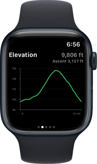
Avalanche forecasts and field observations from across the country.
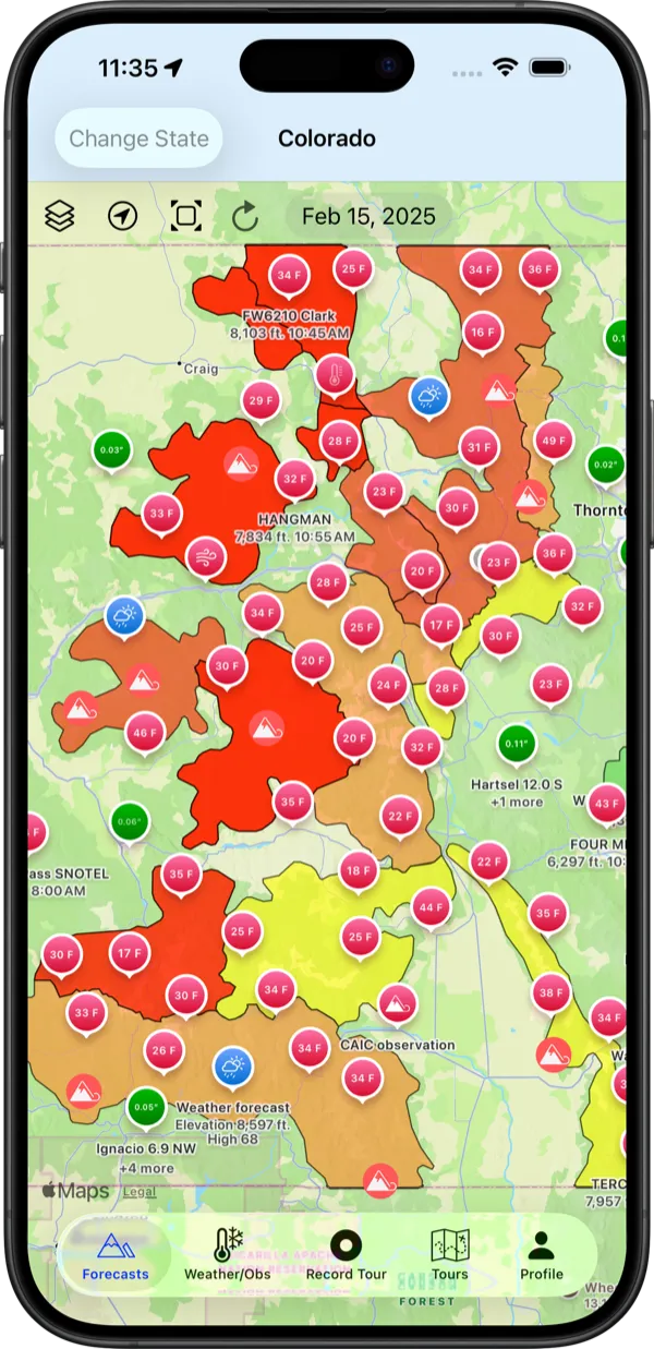
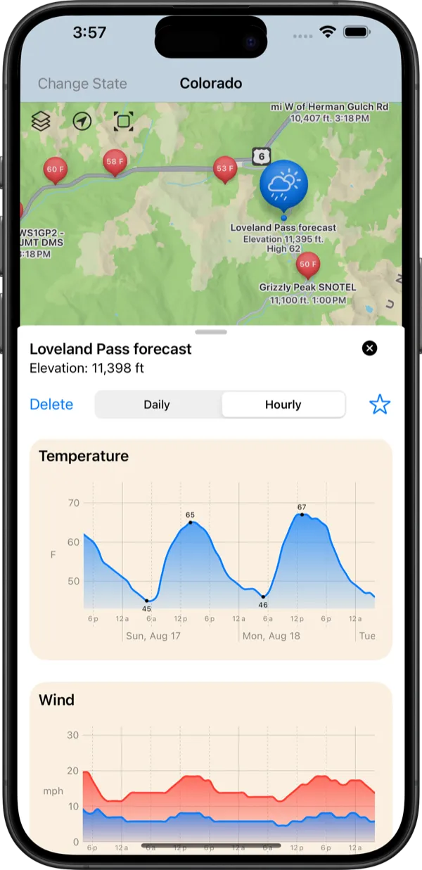
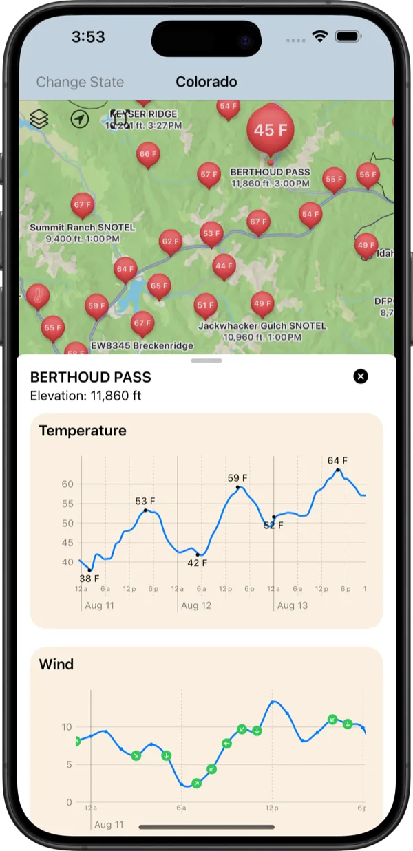
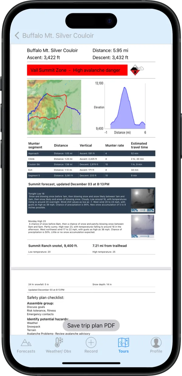
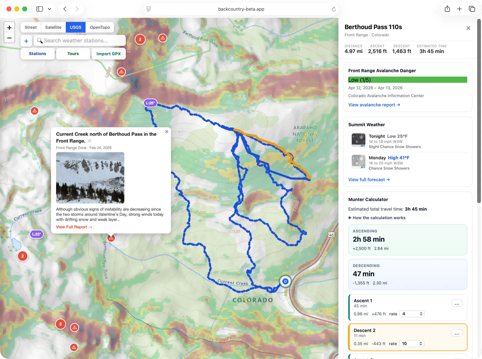
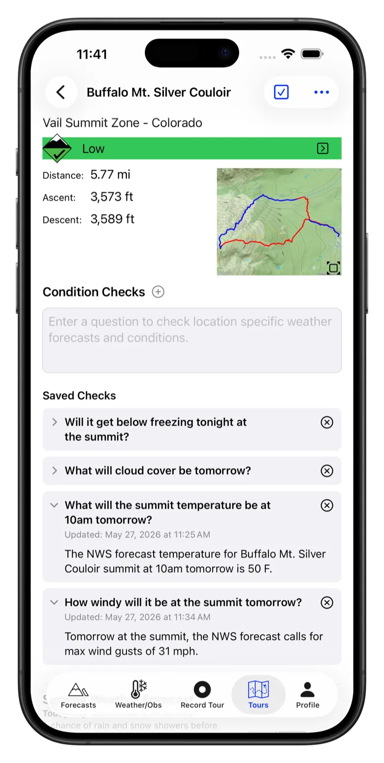
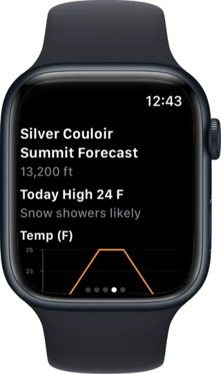
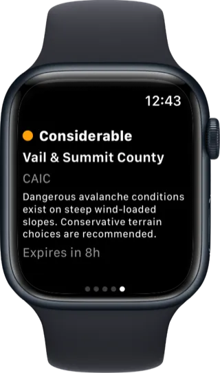
- Know before you go Check danger ratings, avalanche problems, and terrain guidance from local avalanche centers.
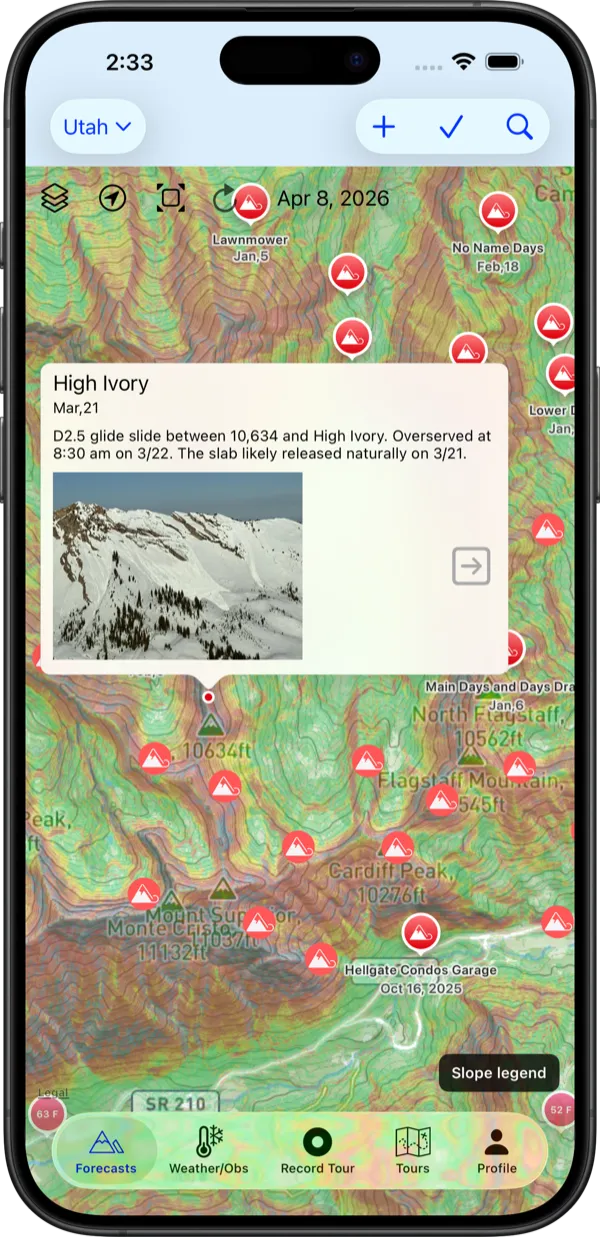
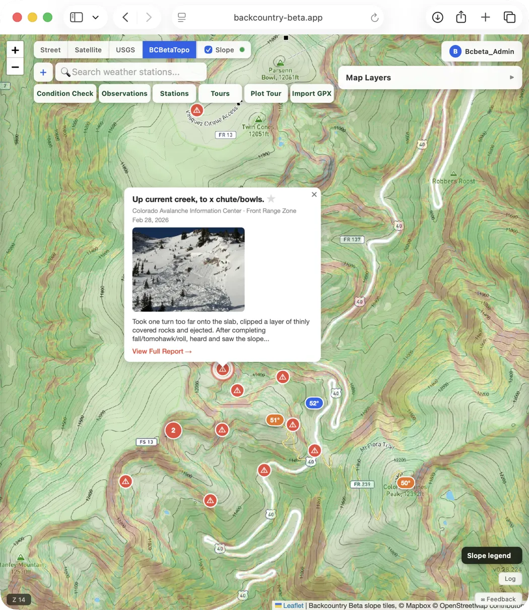
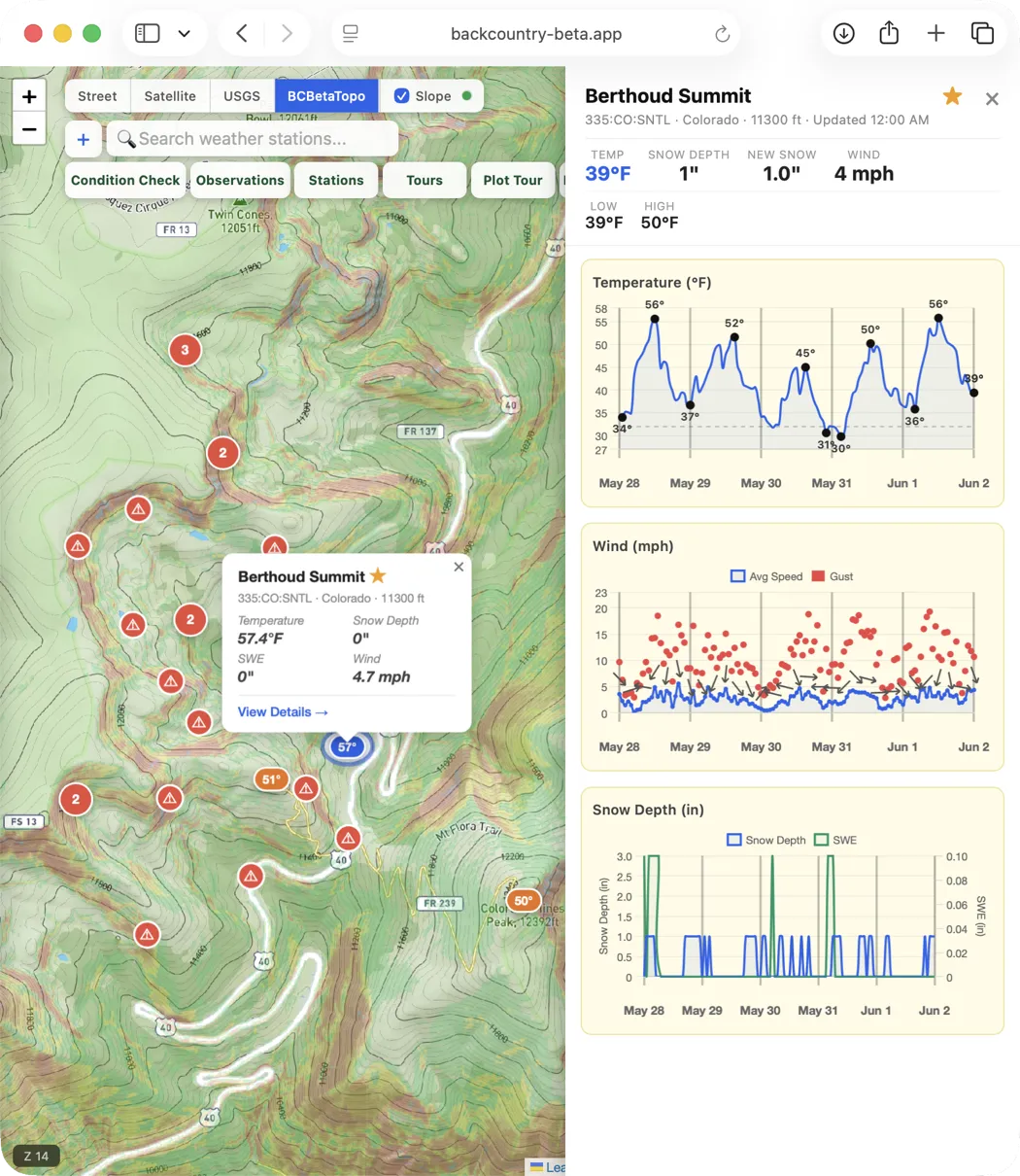
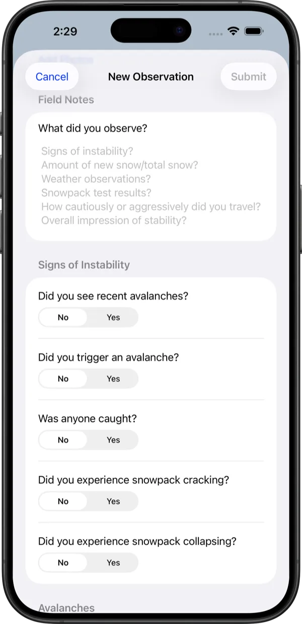
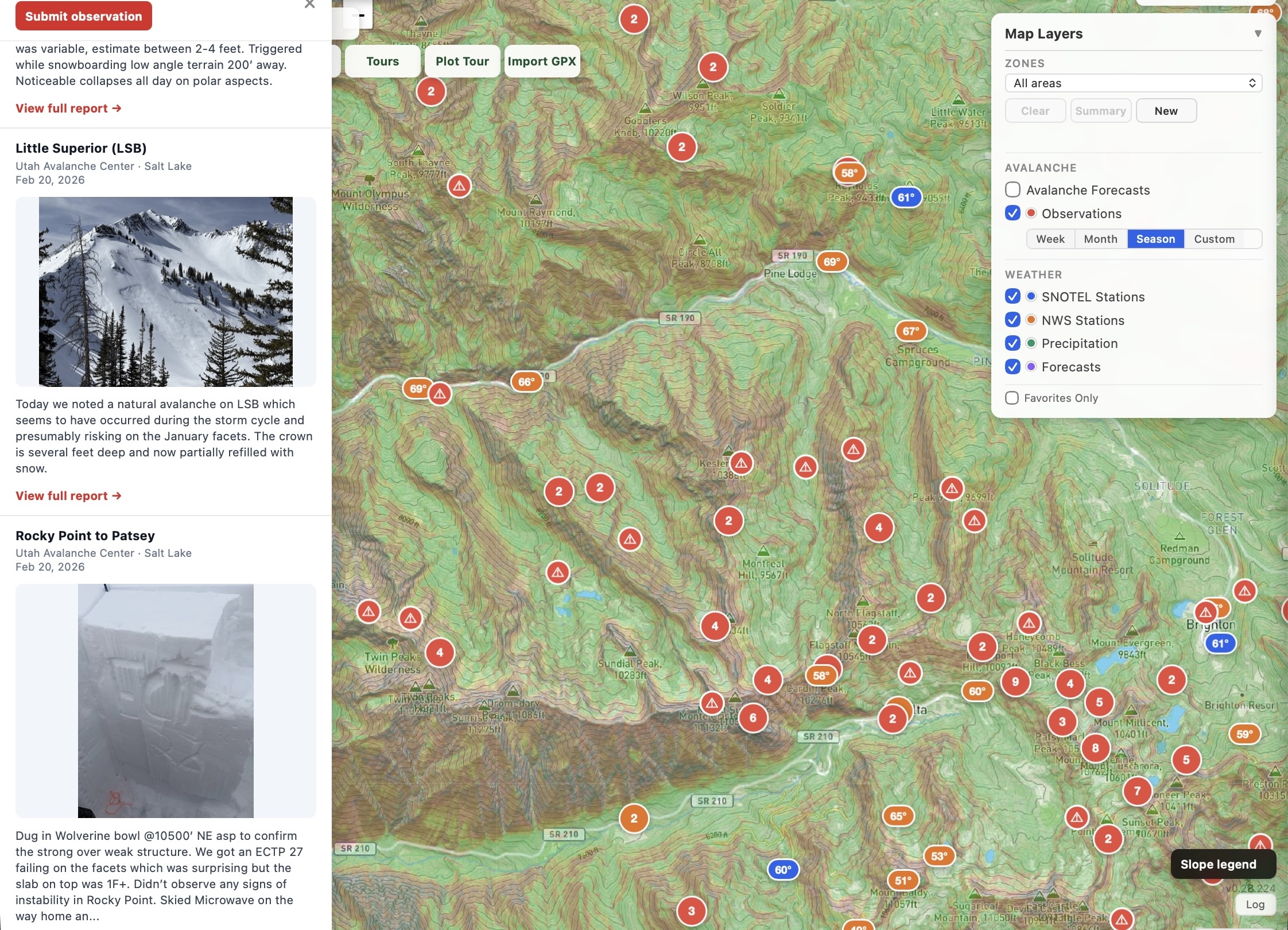
- See the latest field observations View field observations from avalanche centers around the country alongside reports from Backcountry Beta users.
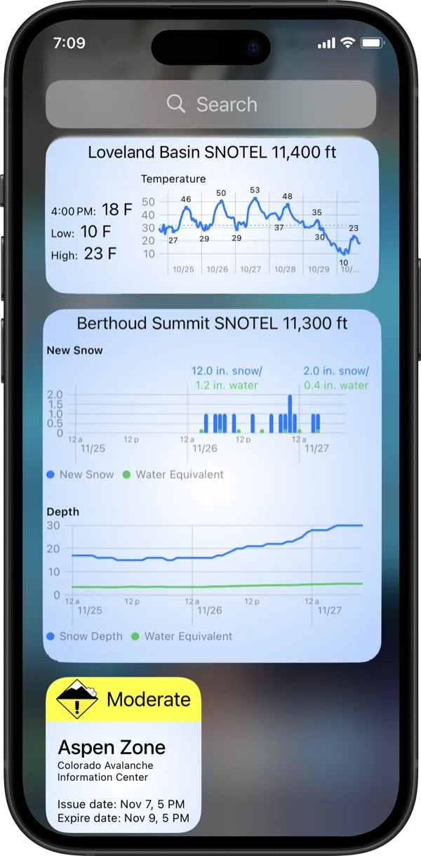
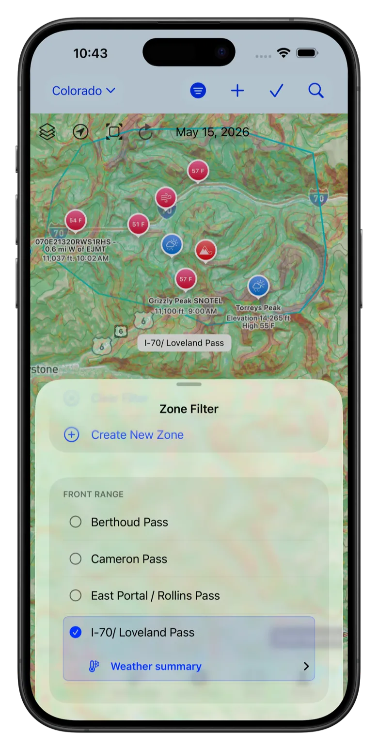
- Custom Zone Monitoring Filter weather and observations according to 30 preset areas or create custom zones to monitor your go-to destinations.